In early 2025, I embarked on my Central American journey once again. Previously, I had visited Guatemala, Costa Rica, and Panama. This trip started from Mexico, heading to Belize, Honduras, and El Salvador. My first stop was Chetumal in the southeastern state of Quintana Roo, Mexico.
Chetumal
Chetumal is situated on the border of Mexico and Belize, while its home state, Quintana Roo, is Mexico’s most renowned tourist state, located on the Yucatán Peninsula. The famous Cancún is also located here. Unlike most Mexican states, Quintana Roo and the neighboring state of Yucatán have consistently been listed by the US Department of State as the only areas with lower security risks, thus attracting a large number of international tourists. However, these tourists are mainly concentrated in Cancún in the northern part of the Yucatán Peninsula. That area boasts beautiful coastlines, fine sandy beaches, and various all-inclusive resorts, making it a favorite for vacationers who enjoy lounging, eating, and drinking. The Yucatán Peninsula is home to numerous ruins of the ancient Mayan civilization, as this was one of the core regions of the Mayan world.
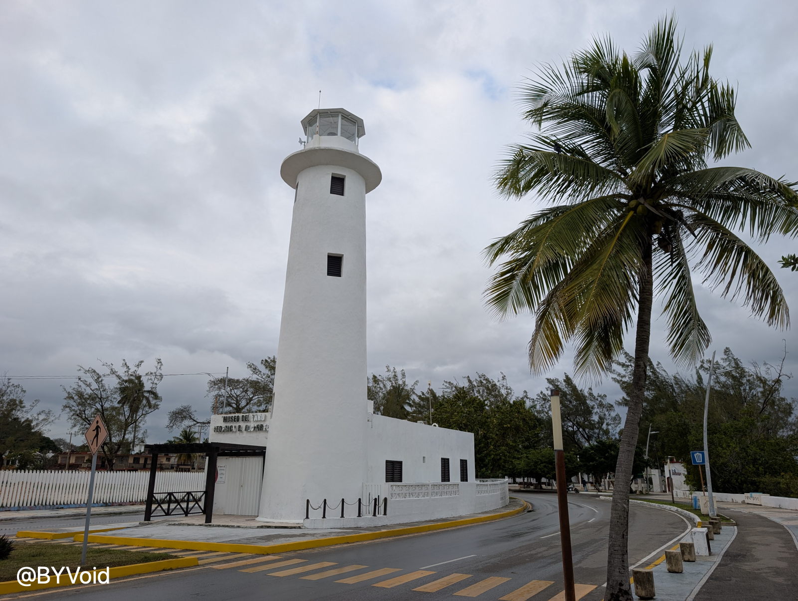
In comparison, the southern city I arrived in—Chetumal—seemed much more deserted. Its fame is far less than that of Cancún, and the number of tourists is significantly lower. I arrived by plane from Mexico City, a flight of about two hours. The plane landed at Chetumal Airport right on the border line, and upon disembarking, the first thing that caught my eye was the stretching tropical rainforest. The natural landscape here appeared very pristine; in other words, the level of development is low. Chetumal is a small town, and apart from some landscaping along the coastal promenade designed for tourists, the overall impression is quite desolate. Since I arrived in the afternoon and there wasn’t much to explore, I only took a walk along the seaside promenade that day.
The hotel I chose was located near the town center, but even so, it was pitch black outside after nightfall, and finding a place to eat was not easy. Fortunately, Quintana Roo’s economy is relatively developed, and it is not on the main drug trafficking routes, so the security situation is relatively decent. The hotel receptionist told me that even though it was dark outside at night, it was reasonably safe to go out.
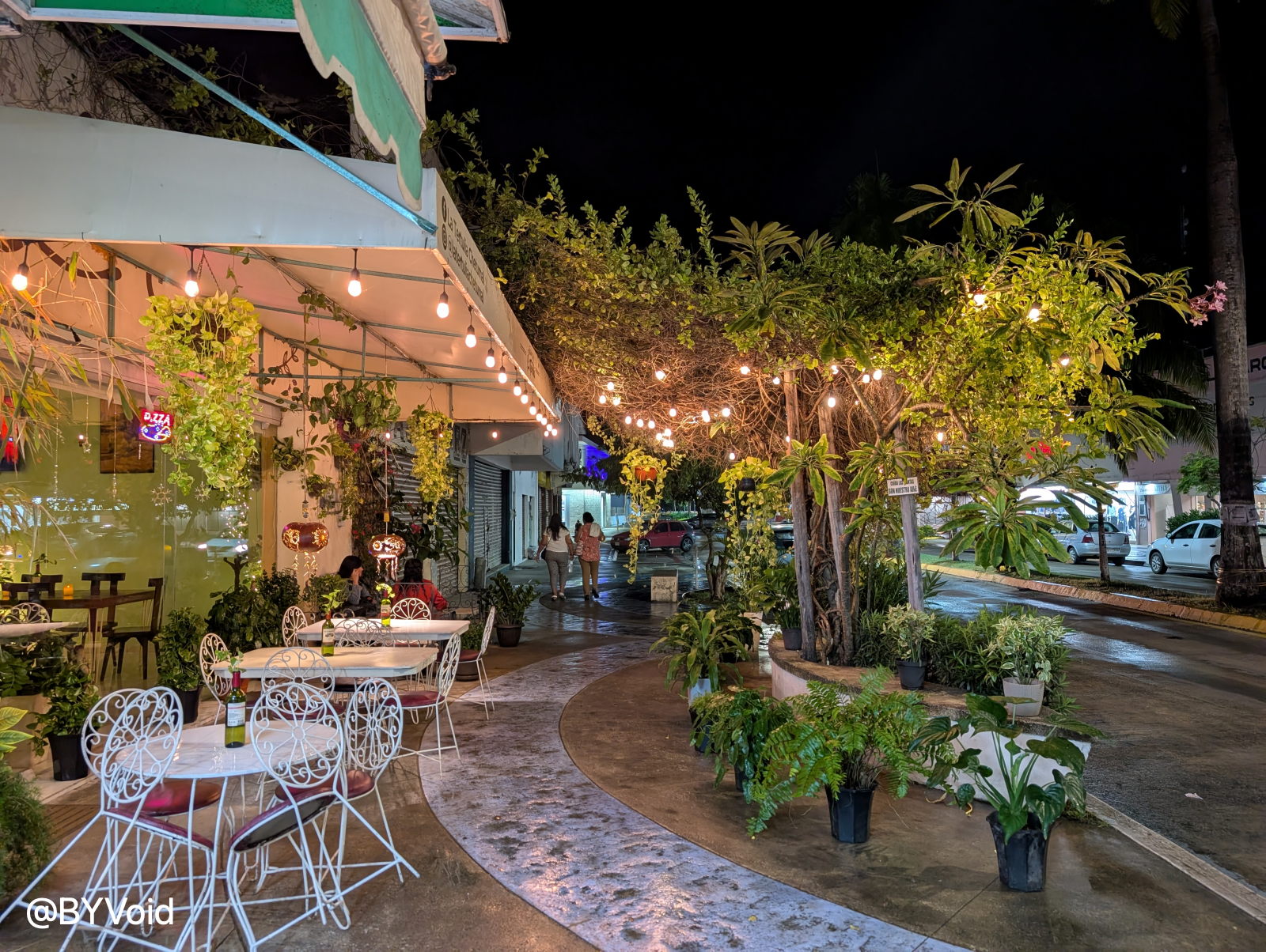
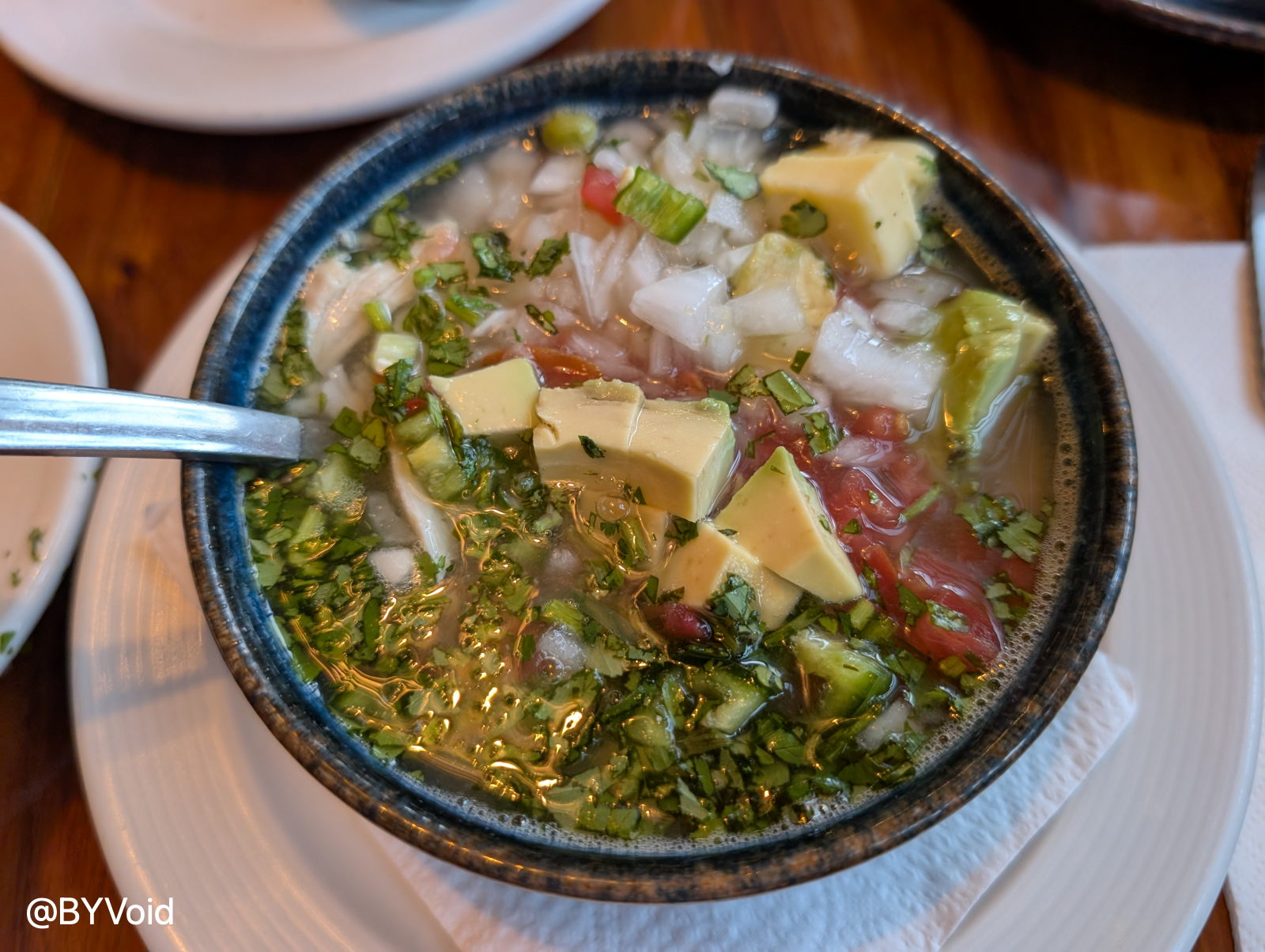
For dinner, I randomly found a local Italian restaurant. Although it was called an Italian restaurant, most items on the menu were still Mexican dishes; the Italian features were limited to pizza and pasta. But then again, isn’t most “Italian food” in the United States similarly localized? This shop’s Caldo Xóchitl (Mexican flower chicken soup) tasted really good.
The Fast Boat to Belize
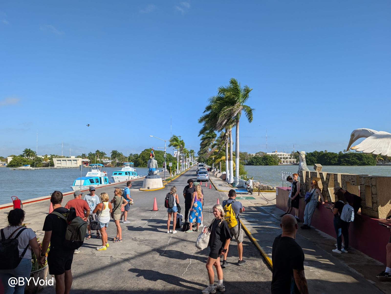
Early the next morning, after a simple breakfast, I walked with my luggage to the seaside pier. This pier is located on the coastline of downtown Chetumal. There are usually few tourists; people only gather here when there is a scheduled boat to Belize.
Before departure, all passengers must first complete Mexican exit procedures at the pier. Generally speaking, if leaving Mexico by plane, there is no formal “exit immigration check,” similar to border controls in the US, Canada, or the UK. This is presumably because airlines report passenger data directly to government agencies, so no extra border check is required. Entering the US by land also doesn’t require a Mexican exit check, but if leaving Mexico via land or water to other Central American countries, one must go through formal border control procedures. I strongly suspect that Mexico is under pressure from the United States to analyze personnel movement information for the US, to facilitate the capture of fugitives fleeing the US by land.
Boat tickets did not need to be booked in advance and cost 1,300 Mexican Pesos. After completing the paperwork for the ticket, I began a long wait. The boat, originally scheduled to depart at 10:00 AM, could not set sail because the Mexican border officials had not arrived. At first, the passengers waited patiently, but as time passed, the atmosphere gradually became anxious. Finally, after who knows how long, several border officials arrived late, dragging their somewhat weary bodies. Fortunately, their efficiency was acceptable; passengers formed a long line, handed over passports for inspection one by one, submitted customs declarations, and were then allowed to board. The customs check went smoothly without any surprises. I had previously read online that crossing the land border from Chetumal into Belize was much more troublesome, involving not only long lines but also potential solicitation of bribes by officials, which is a real headache.
The vessel from Chetumal to Belize was less of a ferry and more of a small skiff, accommodating at most a dozen people. Since it was a speedboat, the cabin was enclosed or semi-enclosed, so one couldn’t go out on deck to feel the breeze like on a regular ferry.
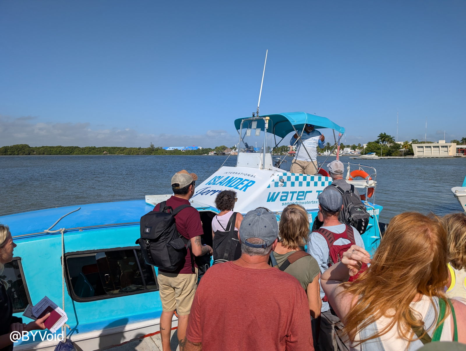
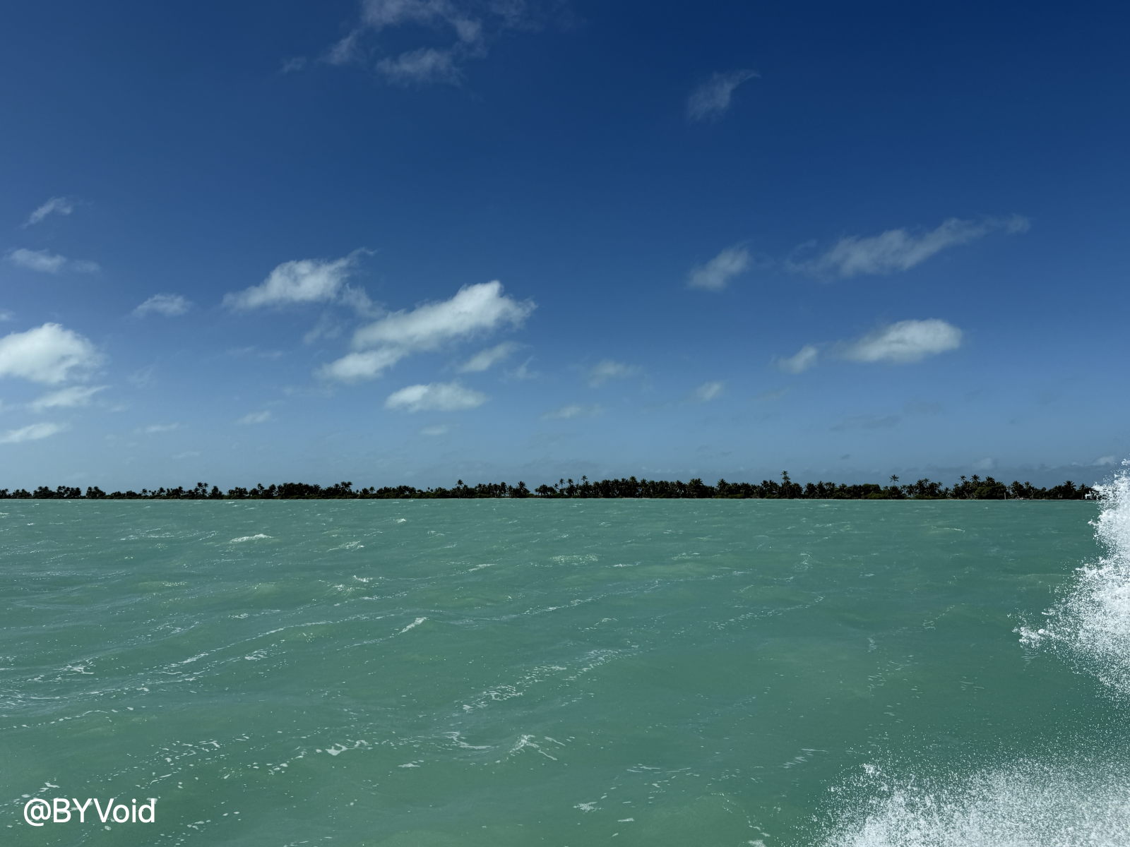
My destination was Belize’s most famous tourist city—San Pedro. The voyage from Chetumal to San Pedro takes about two hours. However, once I was actually on the boat, I found those two hours much harder to endure than I had imagined. The speedboat jolted violently as it moved; even though the sea surface looked calm, the hull was frequently slapped by waves, pitching up and down and causing dizziness. I had assumed that since the route was within a bay, it would be calm, but I didn’t expect the turbulence to be severe enough to make me almost want to vomit. Fortunately, I hadn’t eaten much that morning, otherwise it would have been even more unbearable. Even more awkward was that the prolonged bumping put pressure on my bladder, creating a strong urge to urinate, but there was no toilet on the boat, nor could I stand up in the violent shaking. I could only tough it out, counting the time second by second. After two hours of suffering, the speedboat finally arrived in San Pedro. When the boat entered the harbor and slowed down, the water finally became steady, and the hull stopped shaking; I finally let out a sigh of relief.
The water surface presented a turquoise color, looking exceptionally beautiful under the intense sunlight.
Chetumal Bay and Ambergris Caye
Chetumal Bay is an enclosed body of water, and with rivers injecting fresh water, the salinity is relatively low. My departure point, Chetumal, lies at the mouth of the Hondo River in the western part of the bay, and my destination was San Pedro on Ambergris Caye (Ambergris translates to “Dragon’s Spittle Fragrance”). Ambergris Caye looks like a peninsula on the map, but if you look closely, the border between Mexico and Belize is actually a waterway. According to research, this landmass was actually a peninsula connected to the present-day Mexican mainland. To shorten the route from Chetumal Bay to the Caribbean Sea, the ancient Mayans manually excavated a canal at the narrowest point connecting the peninsula to the mainland. This waterway is the Bacalar Chico, which has a history of over 1,500 years.
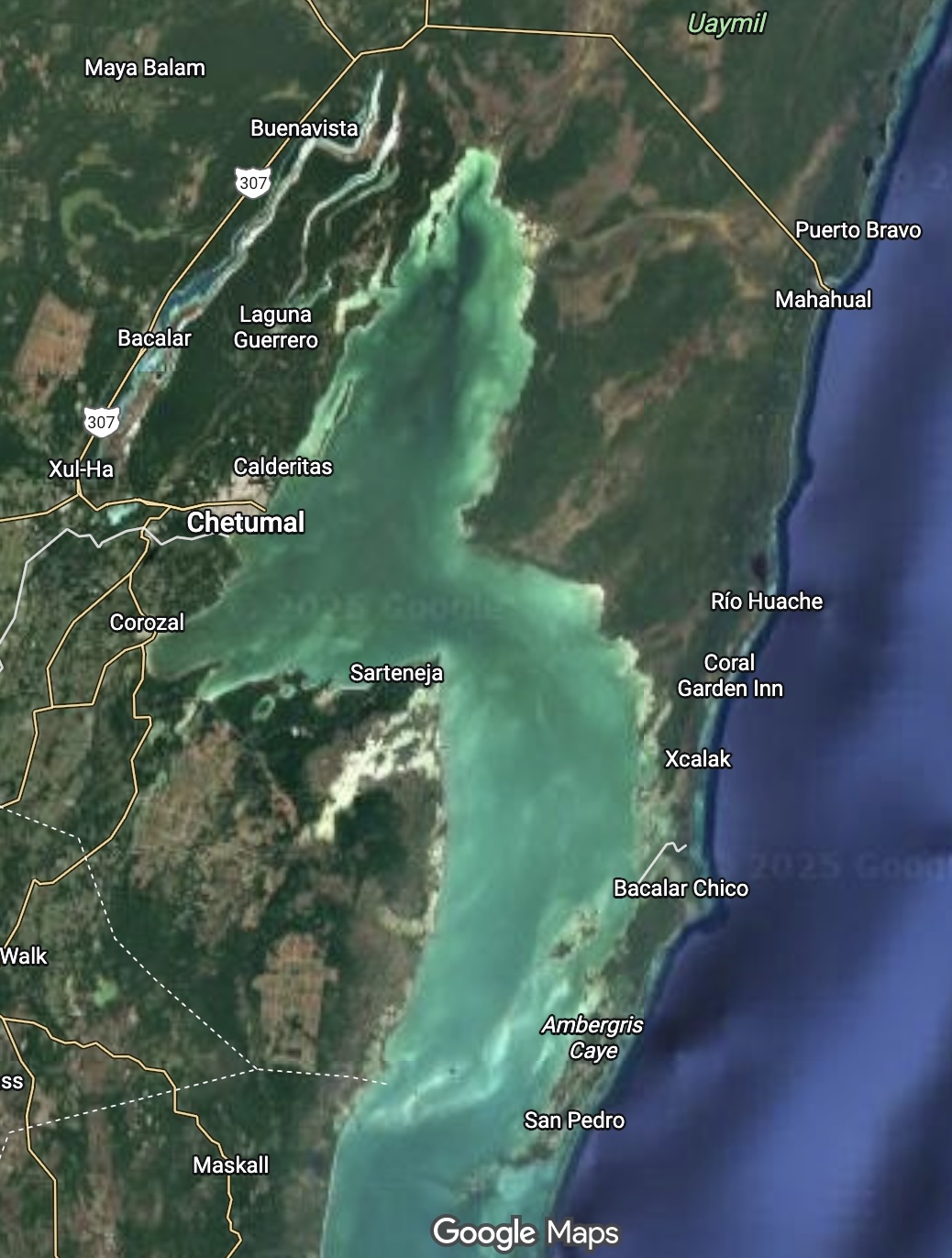
The reason Ambergris Caye became Belizean territory is that in 1893, the United Kingdom and Mexico signed the Mariscal-Spencer Treaty. This treaty defined the territory of British Honduras with the Hondo River and Bacalar Chico as the boundary, so Ambergris Caye to the south became part of what is now Belize. This treaty was effectively Mexico ceding territory in exchange for Britain ceasing its support of the Mayan rebellion during the “Caste War of Yucatán,” and simultaneously, having Britain recognize Mexico’s sovereignty over most of the Yucatán Peninsula—a common tactic used by the British Empire during the Victorian era to manage its global colonial system. During the Caste War, Mayans fled Mexico and established San Pedro on Ambergris Caye, becoming early settlers of British Honduras.
In the next post, I will recount my observations on Ambergris Caye: Central America Travelogue (Part 4): San Pedro.
Last modified on 2025-11-30